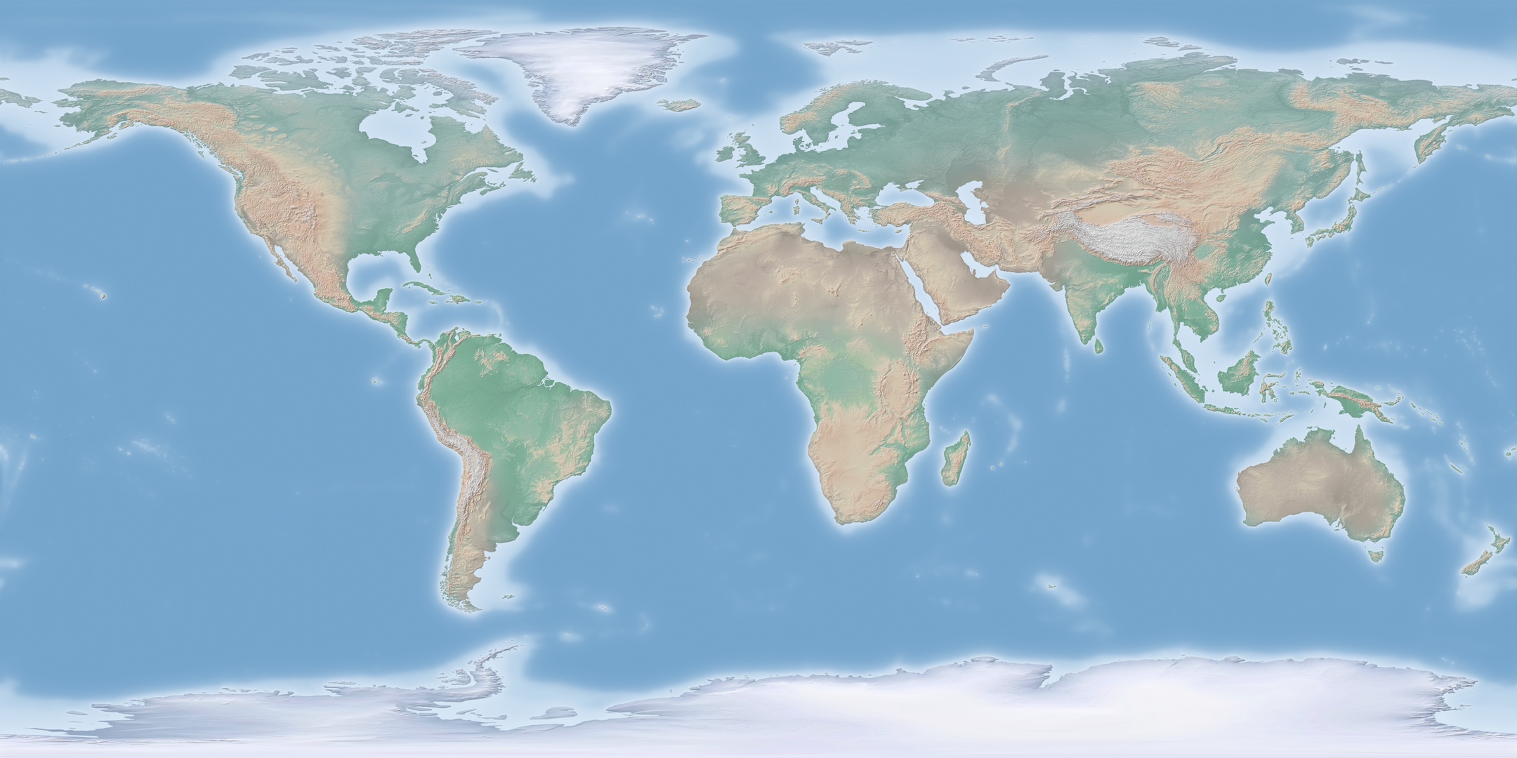
Large GIS raster data derived from Natural Earth Data (Cross Blended Hypso with Shaded Relief and Water)
Funding Information:
Citation:
DataCite ISO 19139 GCMD DIF README.txt BibTex RISIosifescu Enescu, Ionuț (2019). Large GIS raster data derived from Natural Earth Data (Cross Blended Hypso with Shaded Relief and Water). EnviDat. doi:10.16904/envidat.68.
Data and Resources
-
Bulk Data Access
Link to the S3 bucket where all the data resources can be downloaded in bulk
-
map preview 0.5MBJPEG
-
map 0.2GBtif
-
map 0.5GBTIF
-
map 1GBTIF
-
map 2GBTIF
-
large map 10GBGeoTIFF
-
huge map 100GBGeoTIFF
Metadata
| Field | Values |
|---|---|
| DOI | 10.16904/envidat.68 |
| Publication State | Published |
| Authors |
|
| Contact Person | Given Name: Ionuț Family Name: Iosifescu Enescu Email: ionut.iosifescu(at)wsl.ch Affiliation: WSL ORCID: 0000-0002-1770-7833 |
| Subtitles |
|
| Publication | Publisher: EnviDat Year: 2019 |
| Dates |
|
| Version | 1.0 |
| Type | dataset |
| General Type | Dataset |
| Language | English |
| Location | Switzerland |
| Content License |
ODbL with Database Contents License (DbCL)
![[Open Data]](/base/images/od_80x15_blue.png)
|
| Last Updated | April 29, 2022, 04:20 (UTC) |
| Created | March 21, 2018, 15:31 (UTC) |
Custom Metadata
| Custom Field | Values |
|---|---|
| dora_link |