Sample Geodata and Software for Demonstrating Geospatial Preprocessing for Forest Accessibility and Wood Harvesting at FOSS4G2019
Funding Information:
Related Publications
Citation:
DataCite ISO 19139 GCMD DIF README.txt BibTex RISBont, Leo Gallus; Fraefel, Marielle; Iosifescu Enescu, Ionuț (2019). Sample Geodata and Software for Demonstrating Geospatial Preprocessing for Forest Accessibility and Wood Harvesting at FOSS4G2019. EnviDat. doi:10.16904/envidat.75.
Data and Resources
-
Forest vector data (for sample forest range)SHP
EPSG:25832
-
Railways vector data (close to the sample forest range)SHP
EPSG:25832
-
DEM (for the area of the sample forest range)geotiff
EPSG:25832
-
Power lines vector data (close to the area of...SHP
EPSG:25832
-
Digitised sample perimeterSHP
EPSG:25832
-
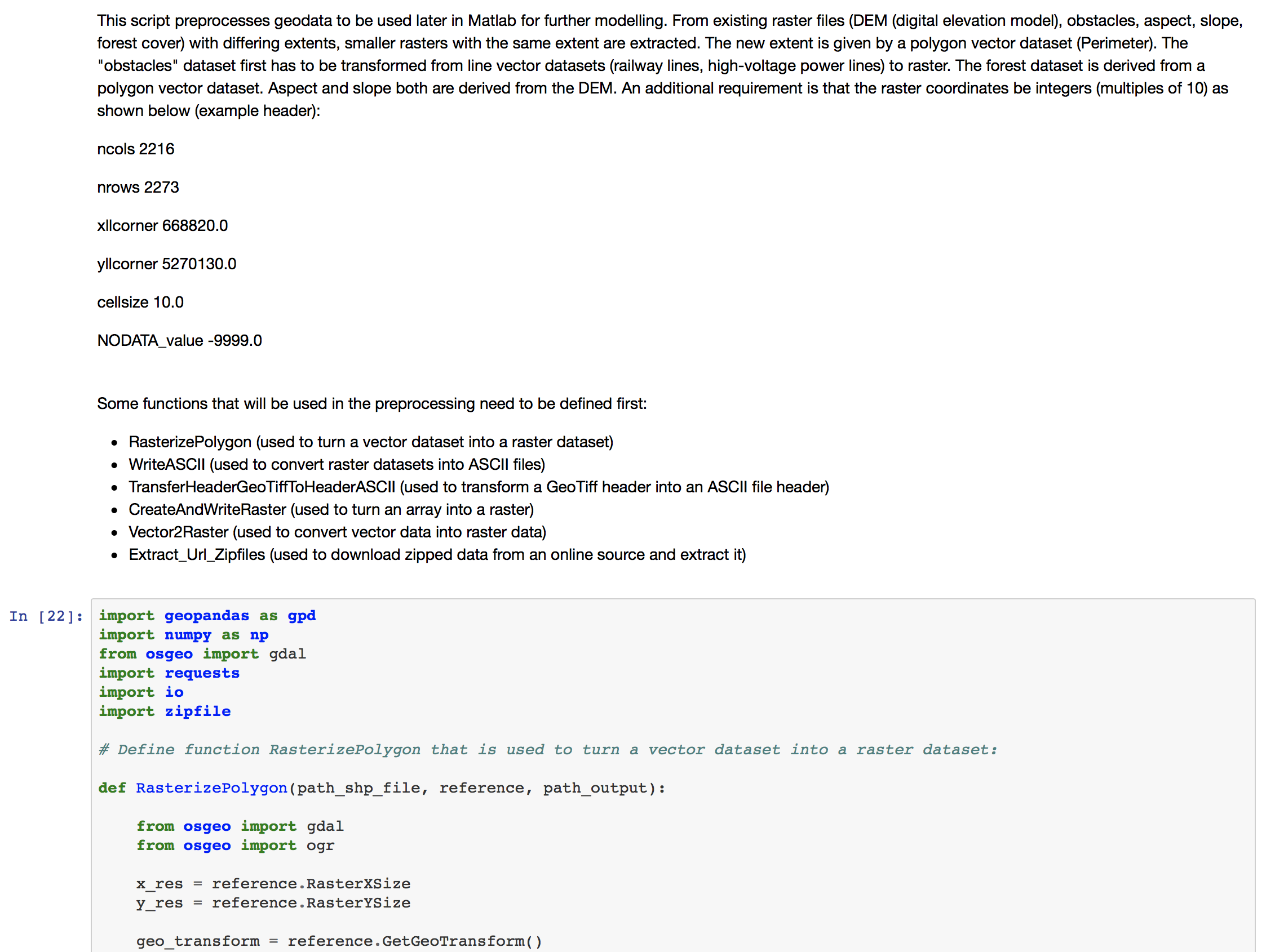
Juypter Notebook for Data Preparationipynb
-
Juypter Notebook for Data Preparation (online)ipynb
-
PreviewPNG
Metadata
| Field | Values |
|---|---|
| DOI | 10.16904/envidat.75 |
| Publication State | Published |
| Authors |
|
| Contact Person | Given Name: Leo Gallus Family Name: Bont Email: leo.bont(at)wsl.ch Affiliation: WSL |
| Subtitles |
|
| Publication | Publisher: EnviDat Year: 2019 |
| Dates |
|
| Version | 1.0 |
| Type | Dataset |
| General Type | Dataset |
| Language | English |
| Location | Germany, Upper Bavaria (Kochel Forest Range / Bayerische Staatsforsten AöR Revier Kochel) |
| Content License |
ODbL with Database Contents License (DbCL)
![[Open Data]](/base/images/od_80x15_blue.png)
|
| Last Updated | December 2, 2019, 22:31 (UTC) |
| Created | May 22, 2019, 08:55 (UTC) |
Custom Metadata
| Custom Field | Values |
|---|---|
| dora_link |