Environmental Data: Grassland-use intensity maps for Switzerland
Description
A rule-based algorithm [(Schwieder et al., 2022)](https://doi.org/10.1016/j.rse.2021.112795) was used to produce annual maps for 2018–2021 of grassland-man...
Citation
Weber, D., Schwieder, M., Ritter, L., Koch, T., Psomas, A., Huber, N., Ginzler, C., Boch, S. (2023). Grassland-use intensity maps for Switzerland. EnviDat. https://www.doi.org/10.16904/envidat.428.
Resources
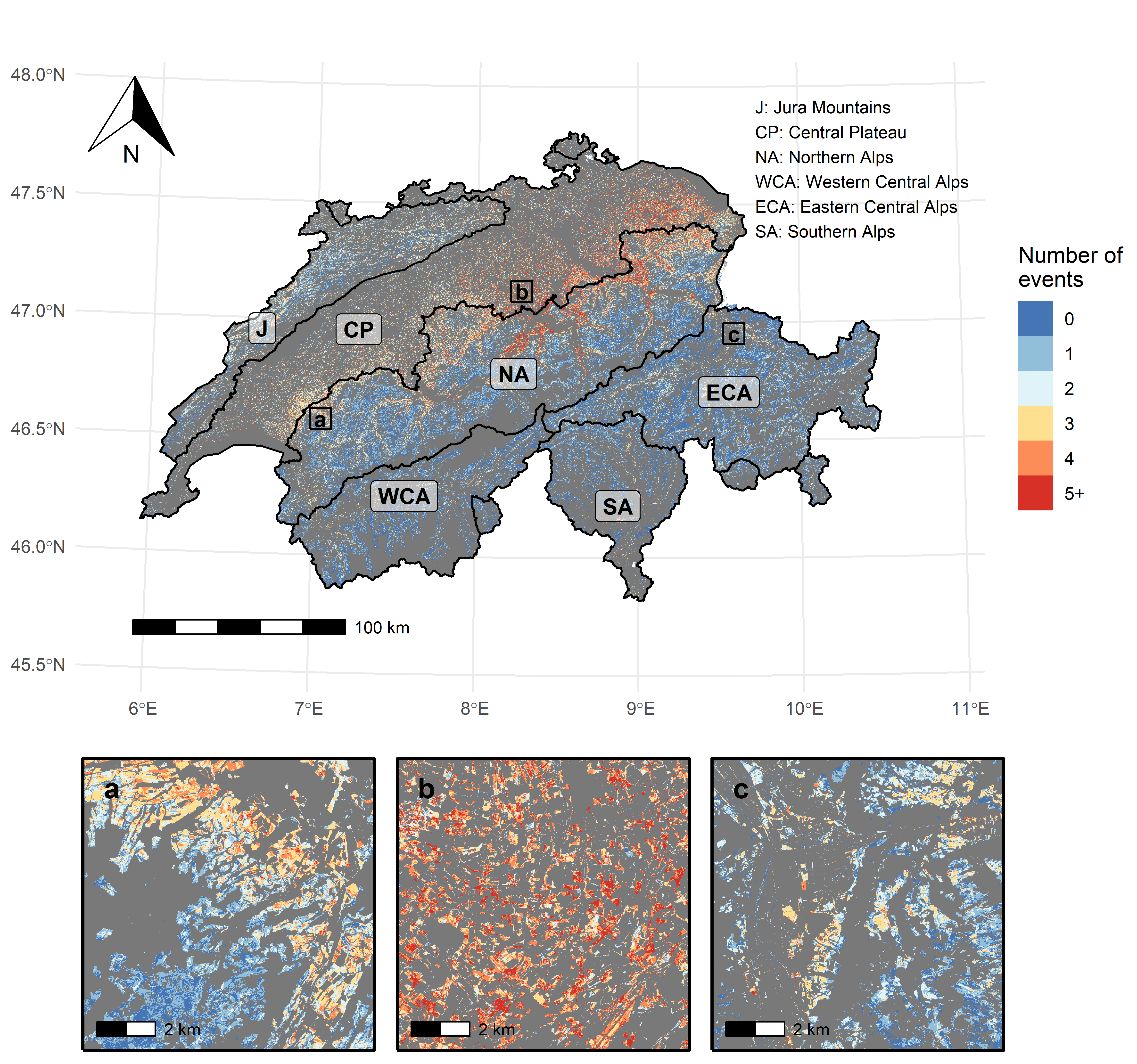
Preview number of grassland management events 2020
Spatial distribution of the number of management events for Switzerland and for three zoomed-in regions (a, b, c). The three zoomed-in regions show different grassland-use intensities, which are reflected in the distribution of management frequency (Weber et al., 2023; IN REVIEW)
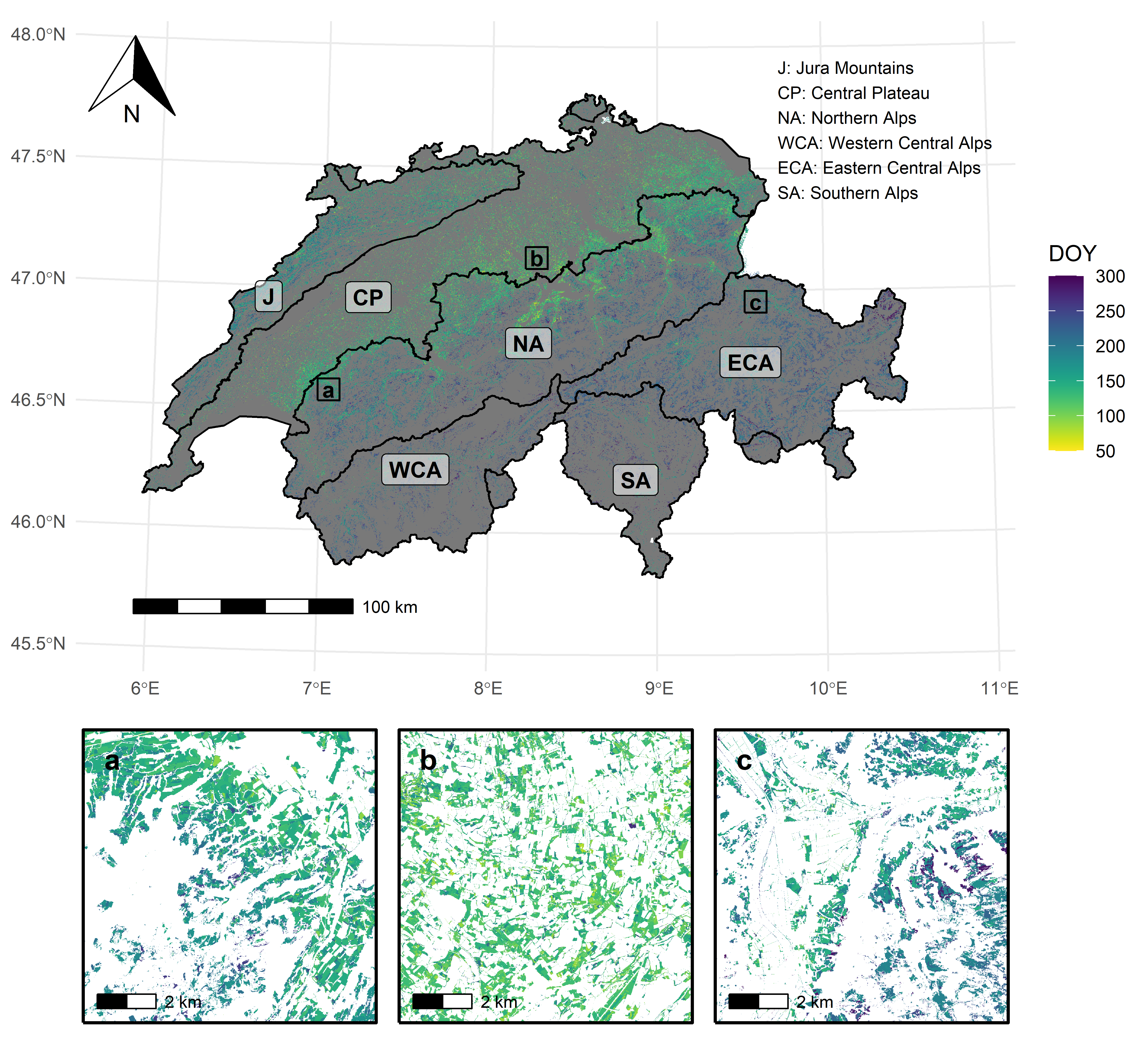
Preview number of grassland management events 2020Preview time of 1st grassland management event 2020
Spatial distribution of the timing (day of year; DOY) of the first management event for Switzerland and for three zoomed-in regions (a, b, c). The three zoomed-in regions show different grassland-use intensities, which are reflected in the timing of the first event of the year (Weber et al., 2023; IN REVIEW)
Preview time of 1st grassland management event 2020Grassland-use intensity map 2018
Raster stack with information on the number and timing of grassland-management events (i.e. mowing, grazing) at a spatial resolution of 10 m × 10 m for the whole of Switzerland for 2018. See readme file for more details.
Grassland-use intensity map 2018Grassland-use intensity map 2019
Raster stack with information on the number and timing of grassland-management events (i.e. mowing, grazing) at a spatial resolution of 10 m × 10 m for the whole of Switzerland for 2019. See readme file for more details.
Grassland-use intensity map 2019Grassland-use intensity map 2020
Raster stack with information on the number and timing of grassland-management events (i.e. mowing, grazing) at a spatial resolution of 10 m × 10 m for the whole of Switzerland for 2020. See readme file for more details.
Grassland-use intensity map 2020Grassland-use intensity map 2021
Raster stack with information on the number and timing of grassland-management events (i.e. mowing, grazing) at a spatial resolution of 10 m × 10 m for the whole of Switzerland for 2021. See readme file for more details.
Grassland-use intensity map 2021Readme
Metadata and description of the maps and webcam-based reference data.
ReadmeWebcam-based reference data
Webcam-based reference data from 2020 and 2021 (see readme).
Webcam-based reference data