Environmental Data: Forest Type NFI
Description
A series of Forest Type NFI datasets covering Switzerland have been produced, and currently available for the years 2023, 2018, and 2016. These datasets pr...
Citation
Waser, L., Ginzler, C., Psomas, A., Rüetschi, M., Rehush, N. (2025). Forest Type NFI. National Forest Inventory (NFI). https://www.doi.org/10.16904/1000001.7.
Resources
Forest Type NFI 2023
**Important note:** This dataset is NOT suitable for analysis at the individual tree crown level because probabilities at the pixel level (e.g., of the broadleaf class) are not allocated to individual trees. Analysis is recommended only for areas larger than 3x3 pixels, i.e. by calculating the mean values, except in rare cases of homogeneous forest stands (either broadleaf or coniferous class). This dataset uses a remote sensing-based approach for a countrywide mapping of the Dominant Leaf Type (DLT) in Switzerland, classifying areas as either broadleaf or coniferous. These datasets have a spatial resolution of 10 m and provide the probabilities (0-100%) of the class broadleaf at the pixel level (covering areas with vegetation height > 3m). The classification approach is based on a Random Forest (RF) classifier, that combines predictors derived from multi-temporal Sentinel-1 and Sentinel-2 data with the SwissAlti3D terrain model. The models were calibrated using digitized training polygons and independently validated data from the National Forest Inventory (NFI). Whereas high model overall accuracies (0.97) and kappa (0.96) were achieved, the comparison of the Forest Type NFI 2023 dataset with independent NFI data revealed deviations in mixed stands. The dataset 'Forest Type NFI 2023' is freely available on request (lars.waser@wsl.ch).
Forest Type NFI 2023Forest Type NFI 2018
**Important note:** This dataset is NOT suitable for analysis at the individual tree crown level because probabilities at pixel-level (e.g., of the broadleaf class) are not allocated to individual trees. Analysis is recommended only for areas larger than 3x3 pixels, i.e. by calculating the mean values, except in rare cases of homogeneous forest stands (either broadleaf or coniferous class). This dataset uses a remote sensing-based approach for a countrywide mapping of the Dominant Leaf Type (DLT) in Switzerland, classifying areas as either broadleaf or coniferous. These datasets have a spatial resolution of 10 m and provide the probabilities (0-100%) of the class broadleaf at the pixel level (covering areas with vegetation height > 5m). The classification approach is based on a Random Forest (RF) classifier, that combines predictors derived from multi-temporal Sentinel-1 and Sentinel-2 data with the SwissAlti3D terrain model. The models were calibrated using digitized training polygons and independently validated data from the National Forest Inventory (NFI). Whereas high model overall accuracies (0.97) and kappa (0.96) were achieved, the comparison of the Forest Type NFI 2018 dataset with independent NFI data revealed deviations in mixed stands. The dataset 'Forest Type NFI 2018' is freely available on request (lars.waser@wsl.ch).
Forest Type NFI 2018Forest Type NFI 2016
This dataset presents a countrywide map with the two classes broadleaf and coniferous in Switzerland based on digital aerial imagery. The spatial resolution of the data set is 3m. The pixel values correspond to the probabilities (0-100 %) of the class broadleaf. The classification approach incorporates a RF classifier, predictors from multispectral aerial imagery (ADS80) and the SwissAlti3D terrain model. The model was tested, trained and validated using 90,000 digitized polygons and achieved an overall accuracy of 0.99 and a kappa of 0.98. Independent validation and plausibility check included the comparison of the predictions with aerial image interpretations of the NFI. Significant deviations were observed, primarily due to an underestimation of broadleaved trees (median underestimation of 3.17%), especially in mixed forest stands. For more details, see Waser et al. (2017). Data 'Forest Type NFI 2016' is freely available on request (lars.waser@wsl.ch).
Forest Type NFI 2016Research Article
Waser, L. T., Ginzler, C., & Rehush, N. (2017). Wall-to-Wall Tree Type Mapping from Countrywide Airborne Remote Sensing Surveys. Remote Sensing, 9(8), 766. https://doi.org/10.3390/rs9080766
Research ArticleThumbnail
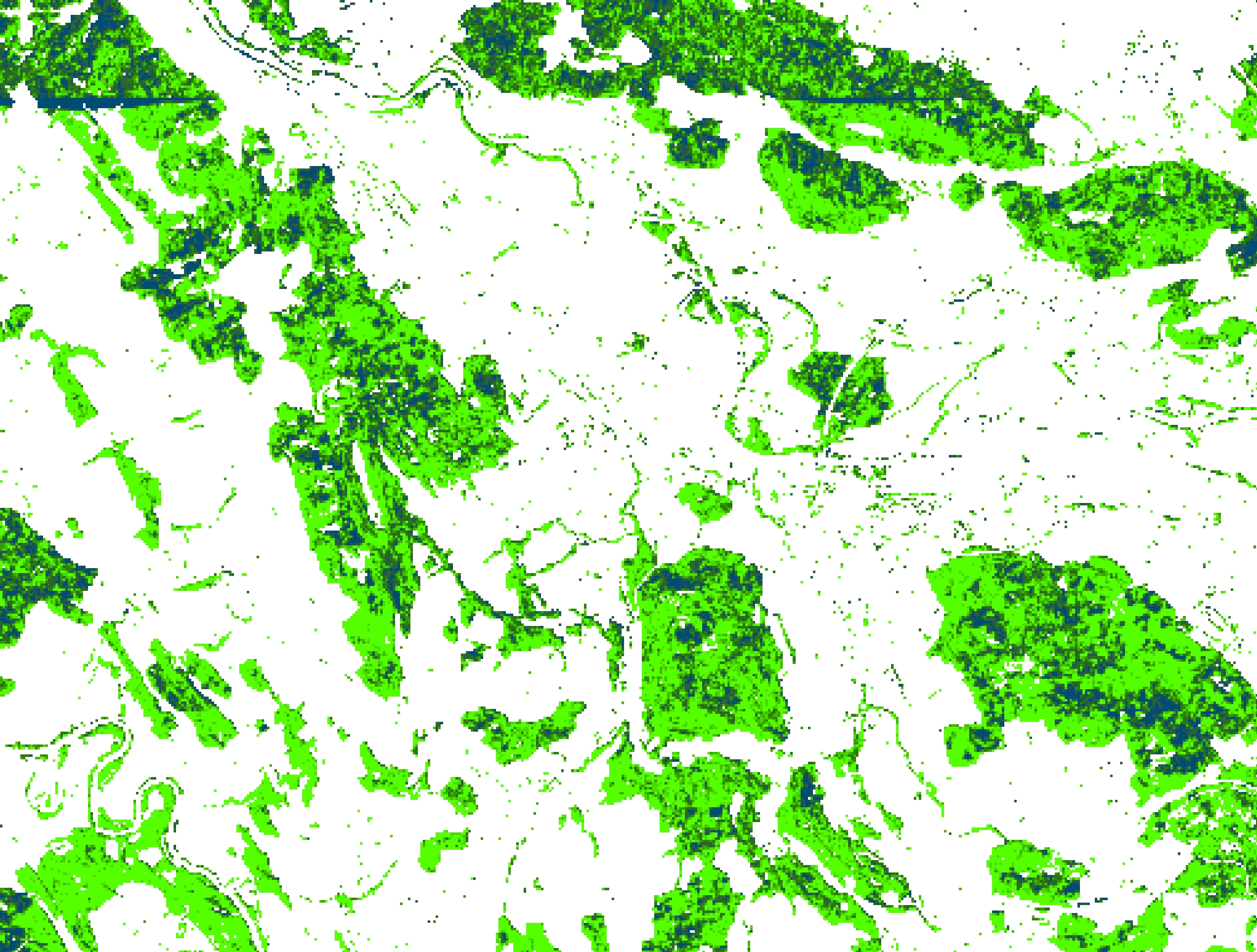
Sample illustration of the Forest Type NFI dataset.
ThumbnailResearch Article
Waser, L. T., Rüetschi, M., Psomas, A., Small, D., & Rehush, N. (2021). Mapping dominant leaf type based on combined Sentinel-1/-2 data – Challenges for mountainous countries. ISPRS Journal of Photogrammetry and Remote Sensing, 180, 209-226. https://doi.org/10.1016/j.isprsjprs.2021.08.017
Research ArticleDataset preview
Preview of the dataset Forest Type NFI 2023.
Dataset preview